
Cinnabar Island
WIP - Izu OoshimaOne Island
 KNOT ISLAND
Friends Gather at Knot Island
Each of the Sevii Islands has two names: a name with the island number, and a name with a word describing the island. One Island is also called Knot Island (結び島 Musubijima in Japanese), symbolizing the connection between Kanto and Hoenn after the Pokémon Network Center begins operation, as well as Johto because of the abundance of Johto-native Pokémon and other Johto connections. The name also references the connection between Bill and Celio.
As for real life inspirations, One Island is based on a few different islands. Starting off with One Island's town, the island it's located on aligns with the real world Shikinejima. Shikinejima is an island mnown for its rocky terrain, having lots of sheer cliffs except around the harbor, where the town is. The town on One Island is located in a similar spot to its real-life counterpart, with much of it being surrounded by cliffs. There aren't really any notable things on One Island to talk about. There is a theory that Shikinejima was once connected to Niijima (the basis for Kindle Road), and was separated by an earthquake in the Edo period. However, there is no evidence indicating that this is true.
South of Shikinejima is Kōzushima, where Treasure Beach is located in the Pokémon games. There are a few beaches on Kōzushima, but Treasure Beach's location lines up most closely with Kayasuhama (返浜), a beach surrounded by mountains at the northermost part of the island. It's a bit hard to get to from the rest of the island, so you can only reach it by car. From here, you can see the other islands on the horizon. In the Pokémon games, Treasure Beach is where items occasionally wash up on the shore, but I'm pretty sure this is just a regular beach thing and nothing specific to Kōzushima.
 Moving on to Kindle Road, it's a long rocky path leading up to Mt. Ember, and also home to the Ember Spa!
The real life inspiration for this area is Nii-jima, which is famous for its white color.
The color is thanks to a type of volcanic rock called Kōkaseki/Kōgaseki (抗火石) which has fire-resistant properties and is
found only on Nii-jima and the nearby islands. While this whiteness isn't reflected in Kindle Road, the fire association is there, and
it's possible that it inspired the white color of Mt. Ember which is just to the north. You know where the sand is whiter though?
Ember Spa!
Moving on to Kindle Road, it's a long rocky path leading up to Mt. Ember, and also home to the Ember Spa!
The real life inspiration for this area is Nii-jima, which is famous for its white color.
The color is thanks to a type of volcanic rock called Kōkaseki/Kōgaseki (抗火石) which has fire-resistant properties and is
found only on Nii-jima and the nearby islands. While this whiteness isn't reflected in Kindle Road, the fire association is there, and
it's possible that it inspired the white color of Mt. Ember which is just to the north. You know where the sand is whiter though?
Ember Spa!
 Ember Spa may be based on the Yunohama Open-Air Bath (湯の浜露天風呂 Yunohama rotenburo), a hot spring on Nii-jima
modeled after ancient Greece and constructed out of the previously mentioned kōgaseki. There's also the Mamashita Onsen (間々下温泉),
another open-air hot spring by the sea. One of its attractions is the sand bath, where the white sand
from the beach is heated with natural hot spring water.
Ember Spa may be based on the Yunohama Open-Air Bath (湯の浜露天風呂 Yunohama rotenburo), a hot spring on Nii-jima
modeled after ancient Greece and constructed out of the previously mentioned kōgaseki. There's also the Mamashita Onsen (間々下温泉),
another open-air hot spring by the sea. One of its attractions is the sand bath, where the white sand
from the beach is heated with natural hot spring water.
 Before we get to Mt. Ember, there are some smaller things to address that I found interesting.
Each piece of land, even if they're just tiny patches of sand in the ocean, usually correlates to a real world location.
For example, the small sandy island at the bottom of Kindle Road matches the size and shape of Hayashima (早島), while the one right in front of
Mt. Ember matches Udonejima (鵜渡根島). There isn't anything of note on these islands though, so they're just empty
patches of sand in the Pokémon games, but it's still cool to see. As far as I know, there aren't any landmasses around here
that are completely made up.
Before we get to Mt. Ember, there are some smaller things to address that I found interesting.
Each piece of land, even if they're just tiny patches of sand in the ocean, usually correlates to a real world location.
For example, the small sandy island at the bottom of Kindle Road matches the size and shape of Hayashima (早島), while the one right in front of
Mt. Ember matches Udonejima (鵜渡根島). There isn't anything of note on these islands though, so they're just empty
patches of sand in the Pokémon games, but it's still cool to see. As far as I know, there aren't any landmasses around here
that are completely made up.
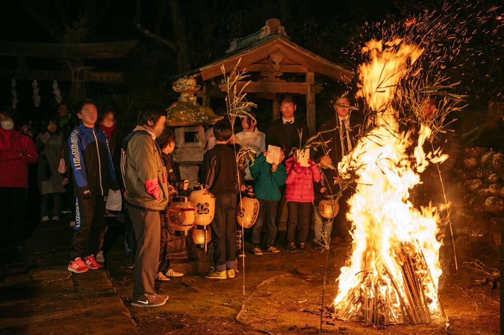 Finally we're at Mt. Ember. In the real world, this would be on the island Toshima (利島).
Toshima is the smallest of the Izu Islands, and Mt. Ember is based on Toshima's highest peak, Miyatsukayama.
Most of the island is covered in camellia trees, but sadly, this isn't shown in the Pokémon games.
On Toshima, the New Year is celebrated at the Azusawake-no-Mikoto shrine (阿豆佐和気命神社), the largest shrine on the island.
Worshippers of the island's deity light a bonfire called the Jikkuwa Fire (ジックワ火) and gather around it, singing the Jikkuwa Fire Song (ジックワ火の歌).
At the peak of Mt. Ember is where the player can capture Moltres, the legendary fire bird Pokémon, and its presence here may be a reference
to this fire tradition.
Finally we're at Mt. Ember. In the real world, this would be on the island Toshima (利島).
Toshima is the smallest of the Izu Islands, and Mt. Ember is based on Toshima's highest peak, Miyatsukayama.
Most of the island is covered in camellia trees, but sadly, this isn't shown in the Pokémon games.
On Toshima, the New Year is celebrated at the Azusawake-no-Mikoto shrine (阿豆佐和気命神社), the largest shrine on the island.
Worshippers of the island's deity light a bonfire called the Jikkuwa Fire (ジックワ火) and gather around it, singing the Jikkuwa Fire Song (ジックワ火の歌).
At the peak of Mt. Ember is where the player can capture Moltres, the legendary fire bird Pokémon, and its presence here may be a reference
to this fire tradition.
According to the Miyakeki (三宅記), a collection of legends about the Izu region's gods, the Izu islands were created by the gods through a process called "island-burning" (島焼き Shimayaki). Here, Toshima is referred to as 十島, meaning Tenth Island, as it was the tenth and final Izu island to be created.
Two Island
BOON ISLANDBoon Island for Two
 The next Sevii Island we will look at is Two Island. On the Town Map, you can see that Two Island is made up of one large island and a smaller island.
In the real world, these would be Miyakejima (三宅島) and Mikurajima (御蔵島) respectively. Mikurajima isn't used for any actual in-game locations, but it's
still represented on the Town Map, so I thought it should be mentioned. Two Island is one of the smaller Sevii Islands that the player can visit, with only
two visitable locations: the town and Cape Brink.
The next Sevii Island we will look at is Two Island. On the Town Map, you can see that Two Island is made up of one large island and a smaller island.
In the real world, these would be Miyakejima (三宅島) and Mikurajima (御蔵島) respectively. Mikurajima isn't used for any actual in-game locations, but it's
still represented on the Town Map, so I thought it should be mentioned. Two Island is one of the smaller Sevii Islands that the player can visit, with only
two visitable locations: the town and Cape Brink.The other name for Two Island is Boon Island. In Japanese, it's called Yuugijima (ゆうぎじま). There's more than one word spelled "yuugi" with different meanings, but both of them apply here. First is 友誼, meaning "friendship", possibly referring to the relationship between the two islands that make up Two Island. There's also the fact that you can go to the Joyful Game Corner here to play with your friends, which brings us to the other yuugi, spelled 遊技 and meaning "playing".
Miyakejima and Mikurajima have a close relationship. The tiny Mikurajima depends on Miyakejima for many things like supplies and transportation, making Mikurajima one of Miyakejima's main markets. In the Pokémon games, Two Island has a small stand where a man sells items, with his inventory growing to include items from other regions the further you progress through the story. This is the only place in FireRed and LeafGreen where you can buy MooMoo Milk and Lava Cookies, specialties of Johto and Hoenn respectively.

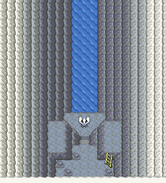
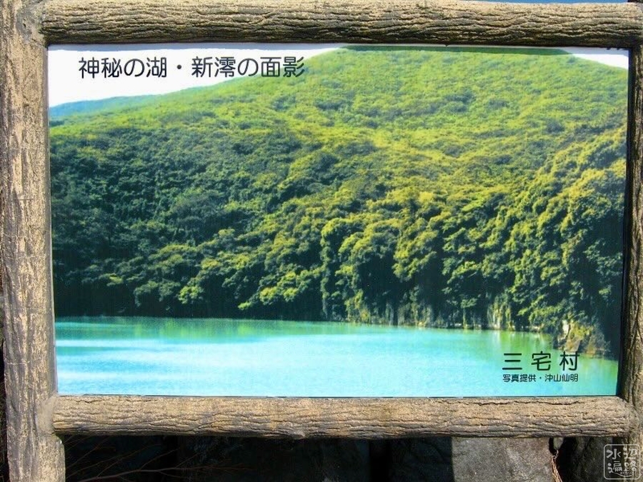 Cape Brink consists of a pond at the top of a mountain that flows down a waterfall into a larger pond. There is a large pond on the real island, known as Tairo-ike (大路池),
and there also used to be Shinmiyou-ike (新澪池), but the latter was completely evaporated in the 1983 eruption.
Shinmiyou-ike was a mysterious pond in a crater surrounded by sheer cliffs that was said to change into each of the seven colors
throughout the day. Today, there are only ruins of the area. While there is no water at the peak of Oyama in real life, the water at Cape Brink
likely took inspiration from both Tairo-ike and Shinmiyou-ike.
Cape Brink consists of a pond at the top of a mountain that flows down a waterfall into a larger pond. There is a large pond on the real island, known as Tairo-ike (大路池),
and there also used to be Shinmiyou-ike (新澪池), but the latter was completely evaporated in the 1983 eruption.
Shinmiyou-ike was a mysterious pond in a crater surrounded by sheer cliffs that was said to change into each of the seven colors
throughout the day. Today, there are only ruins of the area. While there is no water at the peak of Oyama in real life, the water at Cape Brink
likely took inspiration from both Tairo-ike and Shinmiyou-ike.Moving on to the Game Corner, I don't think there's anything important to mention here other than the fact that it's what gave the island its other name. Although, I do wonder where exactly the fence behind the Game Corner leads to. It would be great if Mikurajima got some use and it was where they play Dodrio Berry Picking and Pokémon Jump...
 From the leaks:
At the top of Cape Brink is the house of an old woman who will teach your starter Pokémon one of the ultimate moves, and this is the only way to learn them in any of the Generation III games. In the games, she doesn't have a name, but apparently Game Freak refers to her as the Hyper Move Tutor (ハイパー技教え) in leaked documents. I just thought this would be an interesting fact to mention.
Three Island
KIN ISLANDKin Island of Family Bonding
 Three Island is made up of two islands, the larger Hachijō-jima (八丈島) and the smaller Hachijō-kojima (八丈小島).
Three Island's other name is "Kin Island", or おやこじま Oyakojima in Japanese, meaning parent and child,
referring to the "parent" island and the small "child" island, as well as the plotline revolving
around Lostelle and her father that takes place on this island.
Three Island is made up of two islands, the larger Hachijō-jima (八丈島) and the smaller Hachijō-kojima (八丈小島).
Three Island's other name is "Kin Island", or おやこじま Oyakojima in Japanese, meaning parent and child,
referring to the "parent" island and the small "child" island, as well as the plotline revolving
around Lostelle and her father that takes place on this island.

The island containing Three Island's town is the most populous of the Sevii Islands, the same as Hachijō-jima in the real world. Despite that, the island is shown to usually be peaceful, with multiple NPCs mentioning how sleepy the town is, and the sign on Bond Bridge telling people to be quiet when crossing.
The peace is disturbed by a gang of Bikers who call themselves the Kanto Rider Federation when the player first arrives on the island. This is likely the same group of Bikers who appeared on Route 8 in Gold/Silver/Crystal and called themselves the Kanto Pokémon Federation. The name is slightly different between Gen 2 and Gen 3, but it's definitely supposed to be the same group. This is a nice reference to the Generation 2 games, and they're not the only people from Gold/Silver/Crystal who will reappear on this island.
During the Edo period, Hachijō-jima was used as a place of exile for criminals, with more serious criminals being exiled to Hachijō-kojima. While these Bikers aren't exiles, it's possible that Hachijō-jima's history of criminals led to the idea of the Biker gang showing up.
 Hachijō-kojima was once inhabited, but due to poverty, there was a mass exodus of people
to the main island, leaving Hachijō-kojima uninhabited. In the Pokémon games, this is the island that holds the Berry Forest, where
Berries are said to "grow wildly in profusion". Since there is no clock in FireRed and LeafGreen, the player cannot grow Berries like
in Ruby and Sapphire, making this the only place in FireRed/LeafGreen where players can repeatedly obtain Berries. Berries replenish regularly after
a certain number of steps. In the real world, Hachijō-kojima was a place where a variety of vegetables were grown, with ashitaba (Angelica keiskei)
being most abundant, meaning that even when food was scarce, people could still get green vegetables.
Hachijō-kojima was once inhabited, but due to poverty, there was a mass exodus of people
to the main island, leaving Hachijō-kojima uninhabited. In the Pokémon games, this is the island that holds the Berry Forest, where
Berries are said to "grow wildly in profusion". Since there is no clock in FireRed and LeafGreen, the player cannot grow Berries like
in Ruby and Sapphire, making this the only place in FireRed/LeafGreen where players can repeatedly obtain Berries. Berries replenish regularly after
a certain number of steps. In the real world, Hachijō-kojima was a place where a variety of vegetables were grown, with ashitaba (Angelica keiskei)
being most abundant, meaning that even when food was scarce, people could still get green vegetables.In the Pokémon world, Berry Forest is connected to the town by Bond Bridge. However, there is no such bridge connecting the two islands in the real world. Because of this, Hachijō-kojima had very little interaction with the mainland.
Hachijō-kojima used to be home to a disease which the islanders called "Baku". The people of Hachijō-kojima figured it was unavoidable and that the island's water was poisoned. Divers and fishermen from the mainland would also avoid landing on Hachijō-kojima out of fear of contracting the disease. While there is thankfully no disease there in the Pokémon equivalent of the island, it does bring to mind the fact that Drowzee and Hypno are based on supernatural beings called Baku (This is most likely just a coincidence, but I thought it would be fun to bring up). People on Three Island also seem to be afraid of Berry Forest, with one NPC warning not to go in alone because there are ghosts. There are no ghosts though; there's just a Hypno who took Lostelle, which is based on its Pokédex entry from Generation I.

 The last place on Three Island to discuss is Three Isle Path. Here, there is a man digging a tunnel looking for gold, and he doesn't complete
the tunnel until you obtain the National Pokédex. He says "When I strike it rich, I'm buying a house in KANTO." This is actually the same man
who appeared in GSC, where he has a house on Route 2 in Kanto three years later, so it seems like he really did get rich! This is one of the Sevii Islands'
many connections to the Generation II games. The man appears yet again in Sun and Moon's Malie City, a city with lots of Johto influence,
where he mentions digging up a lot of Nuggets on the Sevii Islands.
The last place on Three Island to discuss is Three Isle Path. Here, there is a man digging a tunnel looking for gold, and he doesn't complete
the tunnel until you obtain the National Pokédex. He says "When I strike it rich, I'm buying a house in KANTO." This is actually the same man
who appeared in GSC, where he has a house on Route 2 in Kanto three years later, so it seems like he really did get rich! This is one of the Sevii Islands'
many connections to the Generation II games. The man appears yet again in Sun and Moon's Malie City, a city with lots of Johto influence,
where he mentions digging up a lot of Nuggets on the Sevii Islands.
As for a real life inspiration for Three Isle Path, it may be based on a cape called Ishizumigahana (石積ヶ鼻). This place is famous among mineral enthusiasts for its sunstones. Apparently, it's fine for visitors to collect the minerals there and take them home! In the Pokémon world, rather than sunstones, the tunnel is known for being a source of gold.
 From the leaks:
A leaked document about the Sevii Islands contains information that "will not be shown to the player". One such piece of information has to do with the rock found in Lostelle's house. It's the only place in the game where this tile shows up, and according to the document, this is because Lostelle's family is related to the Stone family (as in Steven Stone), so her family likes to collect rare gems and stones. This is also reflected by her father's interest in the Meteorite.


Four Island
FLOE ISLANDThe Warm, Blue, Floe Island
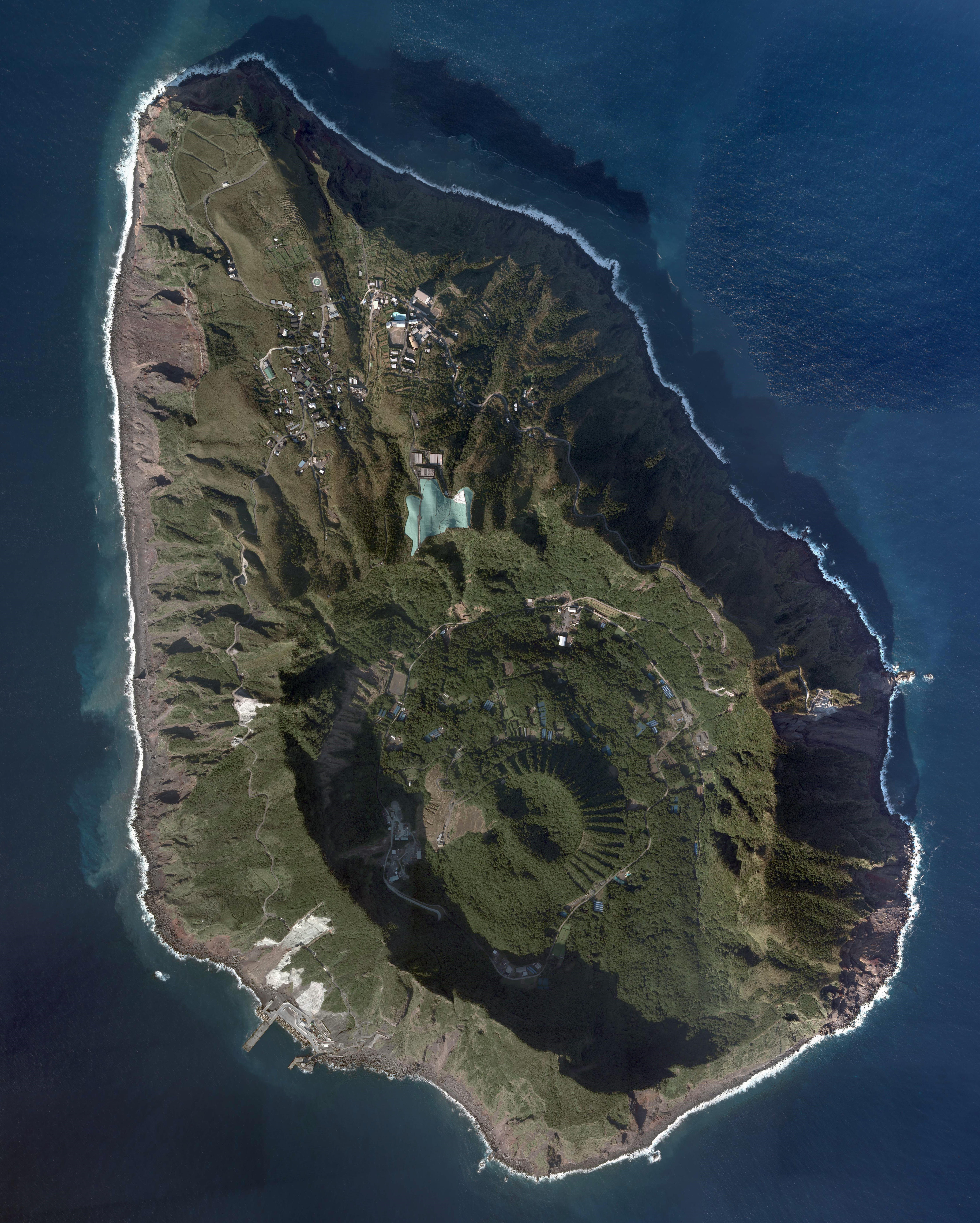
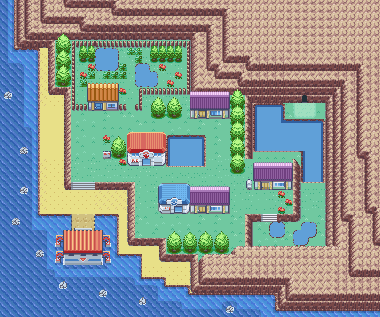 Four Island's real world equivalent would be Aogashima (青ヶ島), the southernmost inhabited Izu Island.
Aogashima means "Blue Island", and this likely influenced Game Freak when making much of Four Island, from the puddles and lakes in the town
to the signpost calling the island blue. Fun fact: this is the only map in FireRed/LeafGreen to have puddles!
Four Island's real world equivalent would be Aogashima (青ヶ島), the southernmost inhabited Izu Island.
Aogashima means "Blue Island", and this likely influenced Game Freak when making much of Four Island, from the puddles and lakes in the town
to the signpost calling the island blue. Fun fact: this is the only map in FireRed/LeafGreen to have puddles!
Four Island is a pretty small island, with the only visitable locations being the town and Icefall Cave. Inside the town, there's the Pokémon Day Care, which lets you breed Pokémon, unlike the Day Care on Route 5, and the island is also home to the Elite Four member Lorelei. Interestingly, Lorelei lives on an island in the anime too, except it's in the Orange Islands. The Orange Islands seem to also be based on the Izu/Ogasawara Islands as well, but very loosely compared to the Sevii Islands, with the only thing in common being the fact that the islands are located south of the Kanto region.
Now, let's compare the layout of Four Island to the real island. If you look at Aogashima, you can see that the location of the port matches, being on the southwestern part of the island. However, as mentioned earlier, the people of Aogashima live on cliffs overlooking the sea, while Four Island's town is in the same place as the port, so not everything matches completely.

 In real life, the island is an active volcano, with a double caldera making up most of the island. The mountain in the middle of the island is called Maruyama (丸山).
Most of the island's population lives on the outer rim of the larger caldera.
Since the houses are on cliffs that overlook the sea, it is sometimes referred to as the "Machu Picchu of the Sea".
Inside the caldera is an area called Ikenosawa (池之沢), whose name comes from the fact that there used to be two ponds in the area: a large one and a small one.
However, both lakes were lost during the Great Tenmei Eruption (天明の大噴火 tenmei no daifunka) of 1785. It is said that the ponds were filled in during the eruption.
If you compare it to Four Island in the Pokémon games, you can see a small pond outside the Pokémon Center, and a large one just outside of Icefall Cave, so this
may have been inspired by the actual history of Aogashima.
In real life, the island is an active volcano, with a double caldera making up most of the island. The mountain in the middle of the island is called Maruyama (丸山).
Most of the island's population lives on the outer rim of the larger caldera.
Since the houses are on cliffs that overlook the sea, it is sometimes referred to as the "Machu Picchu of the Sea".
Inside the caldera is an area called Ikenosawa (池之沢), whose name comes from the fact that there used to be two ponds in the area: a large one and a small one.
However, both lakes were lost during the Great Tenmei Eruption (天明の大噴火 tenmei no daifunka) of 1785. It is said that the ponds were filled in during the eruption.
If you compare it to Four Island in the Pokémon games, you can see a small pond outside the Pokémon Center, and a large one just outside of Icefall Cave, so this
may have been inspired by the actual history of Aogashima.Being a volcano, the island produces a lot of heat, and this may have inspired FireRed/LeafGreen's description of Four Island being "warm". In the Ikenosawa area, you can find steam coming out of holes in the ground due to geothermal heat. The people of Aogashima call it "hingya", derived from hi no kiwa (火の際). meaning "edge of the fire", and it's use for cooking, salt production, and hot springs. When so much of the real life island has to do with heat, it's strange that the biggest thing on Four Island is a cave full of ice, isn't it? Well, Icefall Cave doesn't seem to be naturally made of ice, and this is acknowledged in-game by an NPC in the PokéMart whose dialogue is as follows:
"The SEVII ISLANDS are in a warm region overall. But there is one exception you need to know about.
The ICEFALL CAVE is frigid because of the POKéMON that live in it."

 So, while Icefall Cave is likely based on Maruyama, the only thing it has in common with Maruyama is being a mountain in the same location,
as Aogashima doesn't have an ice cave in real life. Icefall Cave seems to be more of a reference to the Ice Path from Johto.
The same Pokémon that appear in the Ice Path such as Swinub, Sneasel, and Delibird also appear here. Both the Ice Path and Icefall Cave are where
you get the HM for Waterfall. It's a bit sad in FireRed/LeafGreen though, because the only waterfall you have to go up is in the same cave you got the HM.
(There was also a single waterfall at Cape Brink, but it wasn't stopping you from doing/getting anything at all).
So, while Icefall Cave is likely based on Maruyama, the only thing it has in common with Maruyama is being a mountain in the same location,
as Aogashima doesn't have an ice cave in real life. Icefall Cave seems to be more of a reference to the Ice Path from Johto.
The same Pokémon that appear in the Ice Path such as Swinub, Sneasel, and Delibird also appear here. Both the Ice Path and Icefall Cave are where
you get the HM for Waterfall. It's a bit sad in FireRed/LeafGreen though, because the only waterfall you have to go up is in the same cave you got the HM.
(There was also a single waterfall at Cape Brink, but it wasn't stopping you from doing/getting anything at all).
 According to an old woman by the pond, Icefall Cave is where Lorelei caught her Lapras as a child. And you can get one too! Icefall Cave is special because it's the only place in FireRed/LeafGreen where you can catch a wild Lapras. It's found at the very back of the cave.
which could be yet another reference to Johto, specifically the fact that a Lapras can be found swimming on the lowest level of Union Cave every Friday.
(This is also the only way to catch a wild Lapras in Gold/Silver/Crystal. Another interesting thing is that both caves mention in their
descriptions that they are connected to the ocean.
According to an old woman by the pond, Icefall Cave is where Lorelei caught her Lapras as a child. And you can get one too! Icefall Cave is special because it's the only place in FireRed/LeafGreen where you can catch a wild Lapras. It's found at the very back of the cave.
which could be yet another reference to Johto, specifically the fact that a Lapras can be found swimming on the lowest level of Union Cave every Friday.
(This is also the only way to catch a wild Lapras in Gold/Silver/Crystal. Another interesting thing is that both caves mention in their
descriptions that they are connected to the ocean.
 Finally, let's talk about Lorelei's house. It's full of Pokémon dolls! It starts with six dolls inside, but for every 25 wins against the Elite Four,
Lorelei will add a new doll to her house until there are 14 dolls (200 wins). Looks like she's making use of the room decoration feature which was
introduced in Gold and Silver! She even has the Big Lapras Doll which first appeared in Generation II! (Later, Emerald would add one too)
From the leaks:
Finally, let's talk about Lorelei's house. It's full of Pokémon dolls! It starts with six dolls inside, but for every 25 wins against the Elite Four,
Lorelei will add a new doll to her house until there are 14 dolls (200 wins). Looks like she's making use of the room decoration feature which was
introduced in Gold and Silver! She even has the Big Lapras Doll which first appeared in Generation II! (Later, Emerald would add one too)
From the leaks:The explanation behind Icefall Cave's name (In Japanese: いてだきのどうくつ Itedaki no Doukutsu) is that itedaki is a seasonal word used in haiku. It's a word that means "frozen waterfall" and is associated with late winter. The sight of the water being frozen as it falls is described as being beautiful.
The Seagallop Ferry
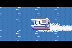 Before we move on to the next couple of islands, let's talk about the boat that takes you between them.
The player rides on the Seagallop Ferries to travel between Vermillion City and the Sevii Islands.
Another one of the boats is used on Cinnabar Island when going to the Sevii Islands for the first time.
Before we move on to the next couple of islands, let's talk about the boat that takes you between them.
The player rides on the Seagallop Ferries to travel between Vermillion City and the Sevii Islands.
Another one of the boats is used on Cinnabar Island when going to the Sevii Islands for the first time.
The Seagallop may be inspired by the boats operated by Tōkai Kisen (東海汽船), a Japanese marine transport company that operates ships connecting Tokyo to the Izu and Ogasawara Islands.
It's unknown whether any specific boats were the inspiration for the Seagallop, but if we look at some of the high-speed ships that were around during FireRed and LeafGreen's development, there's the "Albatross" and "Seven Island". Seven Island was a series of ships named after the Izu Seven Islands, and consisted of "Seven Island Ai", "Seven Island Niji" and "Seven Island Yume". The last words of their names are "love", "rainbow", and "dreams" respectively. The "Seahawk 2" (successor to an older "Seahawk") is also a possible inspiration, having a similar name and being another high-speed ferry.
 The Seagallop may have been named after the word "gallop" or after the Pokémon Rapidash, whose Japanese name is Gallop (ギャロップ).
Either way, its name is meant to convey its high speed.
Leaked content ahead!
The Seagallop may have been named after the word "gallop" or after the Pokémon Rapidash, whose Japanese name is Gallop (ギャロップ).
Either way, its name is meant to convey its high speed.
Leaked content ahead!In the same Pokémon leak that revealed Lostelle's relation to Steven Stone, there was also some interesting information revealed about the Seagallop Ferry. Each time you ride a Seagallop Ferry, the sailor announces the number of the ferry. In game, 7 of these ships are identified, but in actuality, there are a few more. I've written in red the ones whose numbers aren't mentioned in game.
| # | Purpose |
| 1 | Occasionally lent to Sevii Islands residents out of good will. It's the one that came to pick up Bill |
| 2 | Between One, Two, and Three Islands |
| 3 | Between Four and Five Island |
| 4 | Not used because it's bad luck |
| 5 | Between Six and Seven Island |
| 6 | Between islands across different Town Maps |
| 7 | Between Vermillion City and Islands 1-7 |
| 8 | The owner's personal boat (kept secret from his family) |
| 9 | Not used because it's bad luck |
| 10 | Between Vermillion City and Navel Rock |
| 11 | The owner's personal boat (for his family to use) |
| 12 | Between Vermillion City and Birth Island |
As you may have noticed, some numbers aren't used because they are unlucky numbers. In Japan (as well as other countries in Asia), the number 4 can be read as shi, which is the same sound as the word for death (死). Meanwhile, the number 9 can be read as ku, which sounds the same as "suffering" (苦). Because of this, the Seagallop Ferry avoids using these two numbers.
 The final Seagallop-related information from the leak is very interesting. It turns out that the owner of the Seagallop Ferries is
the same man who owns the Trainer Tower. You can even meet him in-game by reaching the very top of Trainer Tower. Although, he'll never
reveal that he owns the Seagallop Ferries, because just like the information about Steven and Lostelle, the documents specifically
say that this will "not be shown to the player".
The final Seagallop-related information from the leak is very interesting. It turns out that the owner of the Seagallop Ferries is
the same man who owns the Trainer Tower. You can even meet him in-game by reaching the very top of Trainer Tower. Although, he'll never
reveal that he owns the Seagallop Ferries, because just like the information about Steven and Lostelle, the documents specifically
say that this will "not be shown to the player".The Sevii Islands' Currents
 While exploring the Sevii Islands, you probably noticed that there are some places where you can't use Surf because the water is too fast.
The main reason for this is likely to explain why players can't simply surf from island to island, but why not just use the regular unsurfable water?
Well, the fast water doesn't even appear on all of the Sevii Islands. It can only be found on Two, Three, and Four Island,
and it may be based on the real life Kuroshio Current (黒潮, meaning Black Current).
The current is poor in nutrients, meaning there aren't many plankton, and the water is clear.
Since there is little reflective material, it gives the water a dark color, which is how it got its name as the
Black Current. It's a fast current, moving at 2 meters (6.5 feet) per second in some spots.
While exploring the Sevii Islands, you probably noticed that there are some places where you can't use Surf because the water is too fast.
The main reason for this is likely to explain why players can't simply surf from island to island, but why not just use the regular unsurfable water?
Well, the fast water doesn't even appear on all of the Sevii Islands. It can only be found on Two, Three, and Four Island,
and it may be based on the real life Kuroshio Current (黒潮, meaning Black Current).
The current is poor in nutrients, meaning there aren't many plankton, and the water is clear.
Since there is little reflective material, it gives the water a dark color, which is how it got its name as the
Black Current. It's a fast current, moving at 2 meters (6.5 feet) per second in some spots.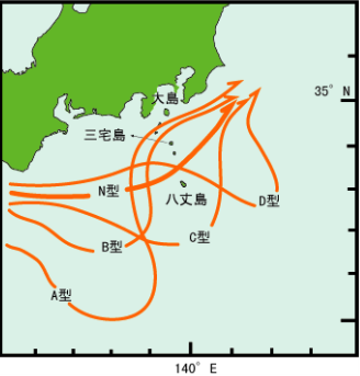 To the side is a map of the typical flow of the Kuroshio Current. As you can see, it passes through the Izu Islands, the basis for Islands 1-4.
The current may be the reason for the items that wash up on the shore of Treasure Beach.
To the side is a map of the typical flow of the Kuroshio Current. As you can see, it passes through the Izu Islands, the basis for Islands 1-4.
The current may be the reason for the items that wash up on the shore of Treasure Beach.Treasure Beach isn't the only place where items regularly appear. Items also regularly wash up on Bond Bridge, Four Island, Resort Gorgeous, Memorial Pillar, Green Path, Outcast Island, Trainer Tower, and the Tanoby Ruins. Not all of these are due to the same current though. There's also the Ogasawara Current, which influences the water around the Ogasawara Islands, which Islands 5-7 are based on.
Navel Rock

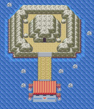 Before we move on to islands 5-7, there's one more island in the way, and that's Navel Rock.
Navel Rock appears in both FireRed/LeafGreen and Emerald, and is a location only accessible with the MysticTicket, which was obtained through Mystery Gift.
Unless you had Pokémon Colosseum or XD, this was the only way to obtain a Ho-Oh and Lugia in Generation III.
Before we move on to islands 5-7, there's one more island in the way, and that's Navel Rock.
Navel Rock appears in both FireRed/LeafGreen and Emerald, and is a location only accessible with the MysticTicket, which was obtained through Mystery Gift.
Unless you had Pokémon Colosseum or XD, this was the only way to obtain a Ho-Oh and Lugia in Generation III.The location is also hidden on the map until you actually travel there, and if you look at the map, you'll see that it's in between Four and Five Island. Compare this to a real-life map, and you'll see that this lines up with an island called Torishima (鳥島), located between Aogashima and Mukojima. There are actually quite a few islands named Torishima, so this one is also called Izu Torishima in order to distinguish it from other Torishimas. The name Torishima literally means "bird island", so it's very fitting that Ho-Oh and Lugia are here. The island got its name from the fact that it is a breeding ground for seabirds like albatrosses.
 From the outside, Navel Rock is a circular island, with the center sticking out, which looks pretty close to the real life island.
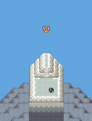
When you go inside Navel Rock, you'll find that there are two paths to take. One is a long climb to the peak of Navel Rock, where you can find Ho-Oh.
The other is a much longer descent to the lowest part of Navel Rock, where Lugia can be found underground near some water.
The structure of Navel Rock may be based on that of the real island. Torishima is an active double volcano. Beneath the seabed, is a submarine volcano
known as Torishima Caldera, which Torishima lies on the southern edge of.
From the outside, Navel Rock is a circular island, with the center sticking out, which looks pretty close to the real life island.
When you go inside Navel Rock, you'll find that there are two paths to take. One is a long climb to the peak of Navel Rock, where you can find Ho-Oh.
The other is a much longer descent to the lowest part of Navel Rock, where Lugia can be found underground near some water.
The structure of Navel Rock may be based on that of the real island. Torishima is an active double volcano. Beneath the seabed, is a submarine volcano
known as Torishima Caldera, which Torishima lies on the southern edge of. 
 Torishima might not be the only inspiration for Navel Rock. A bit to the south of Torishima is Sōfu-iwa (孀婦), a very tall rock pillar,
and the southernmost point of the Izu Islands.
Sōfu-iwa is also part of a submarine volcano, but while Torishima resembles Navel Rock's exterior, Sōfu-iwa resembles the interior.
The above-water portion is 99 meters tall (324.8 feet), while it reaches 2,500 meters (8,202 feet) underwater, just like how the upper half
of Navel Rock is much shorter than the lower half. On the side of this text, I've provided an illustration someone made of the rock that I found online.
(from here)
Torishima might not be the only inspiration for Navel Rock. A bit to the south of Torishima is Sōfu-iwa (孀婦), a very tall rock pillar,
and the southernmost point of the Izu Islands.
Sōfu-iwa is also part of a submarine volcano, but while Torishima resembles Navel Rock's exterior, Sōfu-iwa resembles the interior.
The above-water portion is 99 meters tall (324.8 feet), while it reaches 2,500 meters (8,202 feet) underwater, just like how the upper half
of Navel Rock is much shorter than the lower half. On the side of this text, I've provided an illustration someone made of the rock that I found online.
(from here)Also, this has been pointed out before, but the color of the island changes between its appearances in FireRed/LeafGreen and Emerald. In FRLG, the interior is silver, while Emerald's has a gold interior, possibly as a reference to Pokémon Gold and Silver. In English, Sōfu-iwa is called Lot's Wife, named after someone who turned into a pillar of salt. It was named this way because of the white appearance it gained from being covered in bird droppings. As for the gold color, Torishima's highest peak is on a volcano called Iō-yama (硫黄山), meaning Sulfur Mountain. I feel like they probbaly didn't think this far when deciding the colors of Navel Rock, but you can never have too many interesting facts.
Five Island
WIP - Mukojima, Hari no Iwa, Nakōdo-jima, KitanoshimaSix Island
WIP - Chichijima, Anijima, Otōtojima, Otōtojima StraitSeven Island
It's all sevens!!!Seven Island is based on the Hahajima Islands (母島列島 Hahajima Rettou). Most of Seven Island is on Hahajima, the largest island of the group. Starting with Sevault Canyon, I'm not sure if there's a specific location that served as the basis for it, but there is Chibusayama (乳房山, meaning Breast Mountain, because it's on Mother Island I guess.). It's the tallest mountain on Hahajima, and Sevault Canyon may be somewhere around here. There is one interesting thing about the canyon though. At the Canyon Entrance, there's a sign that reads "TRAINERS are asked to refrain from damaging plants in the CANYON."
Now, let's look at the name of Sevault Canyon. Its name in Japanese is しっぽうけいこく, shippō keikoku. The word shippō (七宝) refers to the seven treasures mentioned in Buddhist texts, which are: gold, silver, lapis lazuli, quartz, giant clam shell, coral, and agate. As for why this is in the location's name, it might have just been for the reference to the number seven. This is probably also the case for the next area: the Tanoby Ruins.

 In Japanese, the area is called Asukana Ruins (アスカナいせき). It's an anagram of the rōmaji spelling of Nanakusa (without an N),
referring to the Haru no Nanakusa (Seven Herbs of Spring). These herbs are the some of the first to sprout in the spring,
so on January 7th (known as 人日 Jinjitsu, Human Day), there is a tradition of eating them for good health and protection from illness.
Each chamber's name comes from an herb. Enjoy this table lifted from Bulbapedia:
In Japanese, the area is called Asukana Ruins (アスカナいせき). It's an anagram of the rōmaji spelling of Nanakusa (without an N),
referring to the Haru no Nanakusa (Seven Herbs of Spring). These herbs are the some of the first to sprout in the spring,
so on January 7th (known as 人日 Jinjitsu, Human Day), there is a tradition of eating them for good health and protection from illness.
Each chamber's name comes from an herb. Enjoy this table lifted from Bulbapedia:| English | Japanese | Herb |
| Monean Chamber | イレスのせきしつ Ires no Sekishitsu | 芹 seri, Japanese parsley |
| Liptoo Chamber | ナザンのせきしつ Nuzan no Sekishitsu | 薺 nazuna, shepherd's purse |
| Weepth Chamber | ユゴのせきしつ Ygo no Sekishitsu | 御形 gogyō, Jersey cudweed |
| Dilford Chamber | アレボカのせきしつ Areboka no Sekishitsu | 繁縷 hakobera, chickweed |
| Scufib Chamber | コトーのせきしつ Kotoh no Sekishitsu | 仏の座 hotokenoza, nipplewort |
| Rixy Chamber | アヌザのせきしつ Anuzu no Sekishitsu | 菘 suzuna, turnip |
| Viapois Chamber | オリフのせきしつ Nuzan no Sekishitsu | 蘿蔔 suzushiro, Japanese radish |
 Someone's buried in the Tanoby Ruins
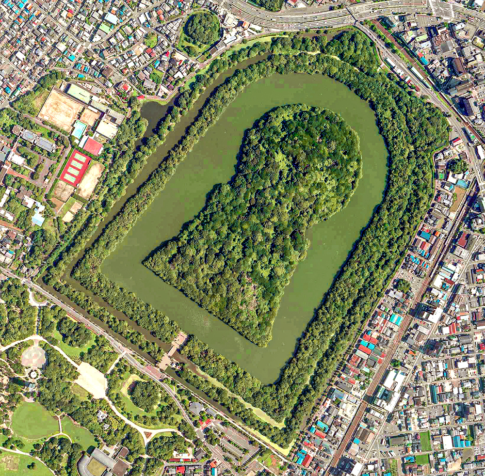
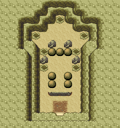
The real secret of the Tanoby Ruins though, is the purpose of the chambers. In Japanese, the word used for chamber is 石室 (せきしつ sekishitsu), which is specifically a burial chamber, meaning that the Tanoby Chambers are actually seven graves. Additionally, Tanoby Key, which must be completed before releasing the Unown, resembles a Kofun (古墳), an ancient burial mound. The most common type is a zenpō-kōen-fun (前方後円墳), which are known for their keyhole shape. Like Tanoby Key.
According to one Hiker, the ruins are at least 1,500 years old, which would date it back to the Kofun period, when Kofun were built (that's how the period got its name). The Tanoby Ruins are obviously a reference to Johto's Ruins of Alph, where Unown first appeared, but the Ruins of Alph also correspond to some kofun: specifically the Ishibutai Kofun and Takamatsuzuka Tomb. This makes FireRed and LeafGreen the second time that Unown are associated with burials.
 So what about a real world parallel?
The Tanoby Ruins line up with the islands to the south of Hahajima. I'm not sure which ones exactly, but the largest ones include Mukoujima, Hirajima, Anejima, Imōtojima, and Meijima. These islands don't seem to have anything similar to the Tanoby Ruins in real life, but if we go a bit south, to North Iwo Jima, we can find some ruins, called Ishino Iseki (石野遺跡). Here, there is a mysterious megalith with symbols carved into it. Giant clam shells and coral are placed on piles of pebbles, similar to ancient tombs in Okinawa, suggesting that it may have been a burial site. It's possible that the Tanoby Ruins were somewhat inspired by this, but moved to a closer location when making the game.
Birth Island
WIP - Minamitorishima